
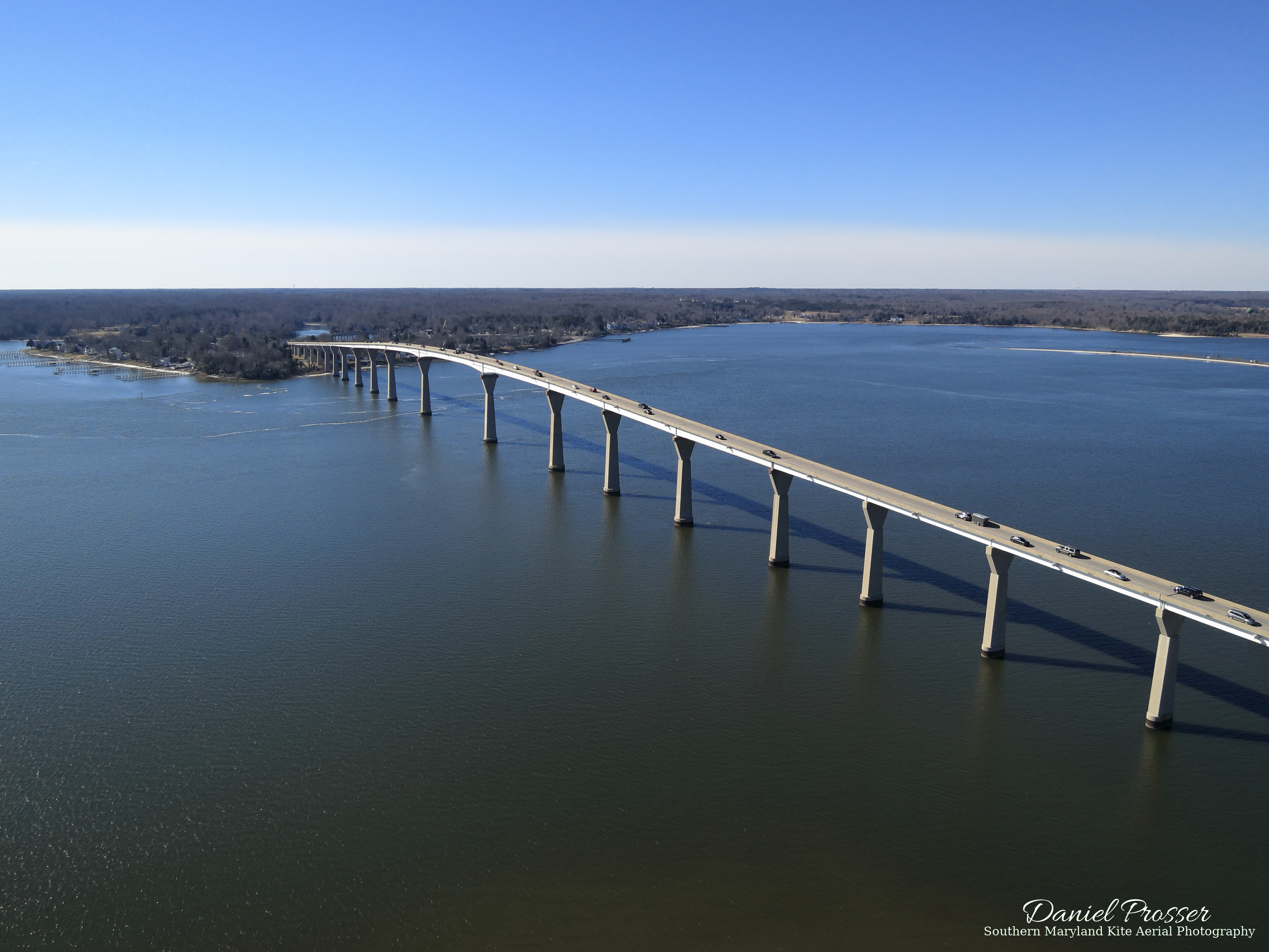
The Governor Thomas Johnson Bridge is one of the most recognizable landmarks of Southern Maryland. It crosses the Patuxent River, joining St. Mary’s County and Calvert County, the two southernmost counties in Southern Maryland. It also is fairly long and tall, making it visible from fairly long distances; as such, it has already appeared in a few of my aerial photo shoots from other locations. You can find it on the main cover page for this site, for example.
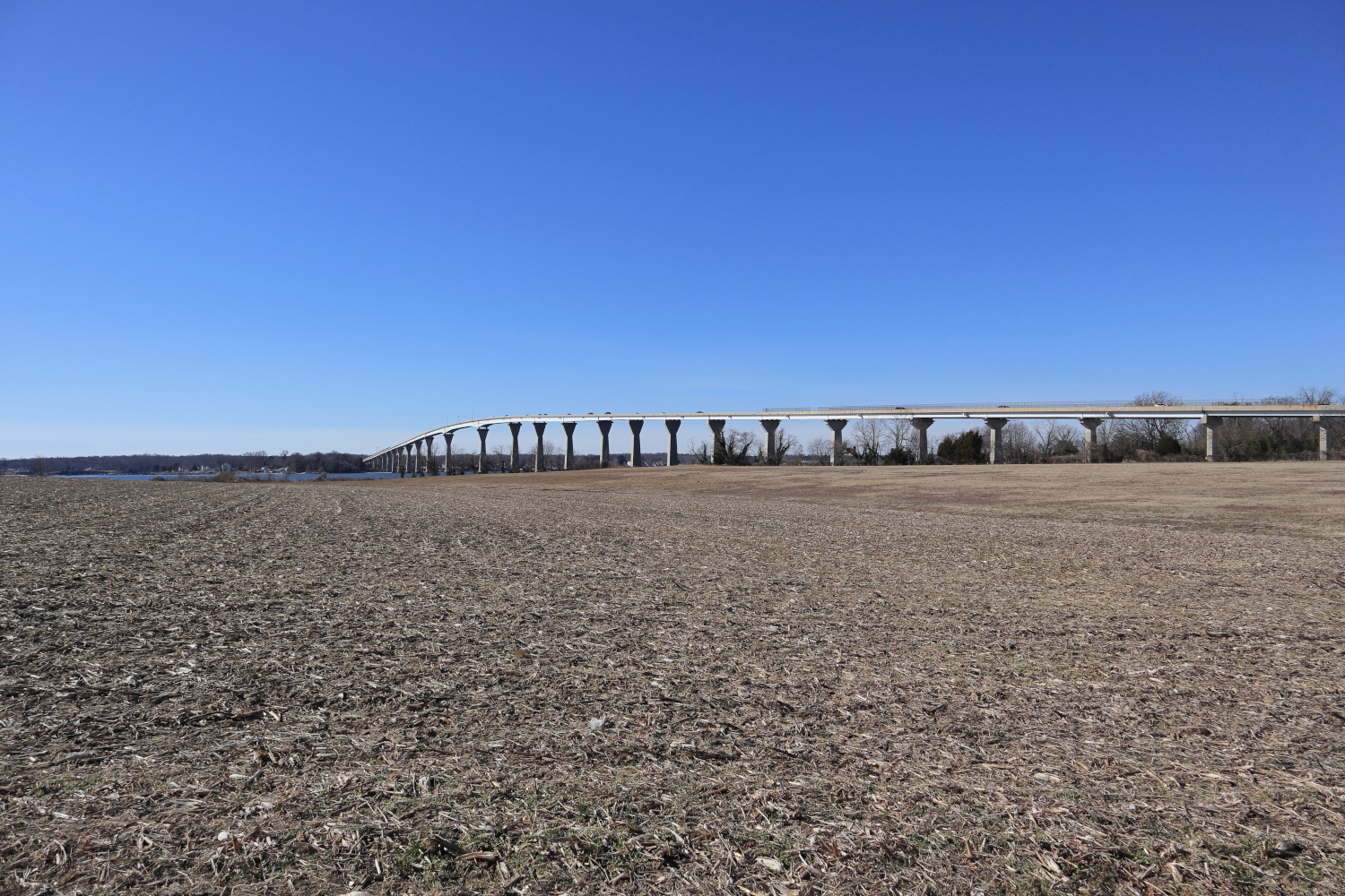
Some Google sleuthing revealed that there is a large empty field next to the bridge, which, as far as I can tell, is not private property. There is even a kite fly-in that normally occurs there every year, so it has to be a good place to fly kites. Here is what the flying site looked like from the road when I arrived:
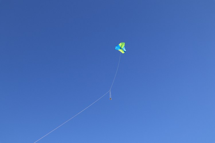
It was a bit of a walk from the road to the edge of the water where I wanted to fly, but it wasn’t too bad. The wind was kind of in-between the range of my two kites. It seemed like it might be somewhat of a struggle to get the Mini Dopero off the ground, but at treetop level it was blowing pretty steadily. I decided to fly the bigger Barn Door kite despite the fact that it might pull pretty hard at times, because I knew it would be easy to get in the air in this wind.
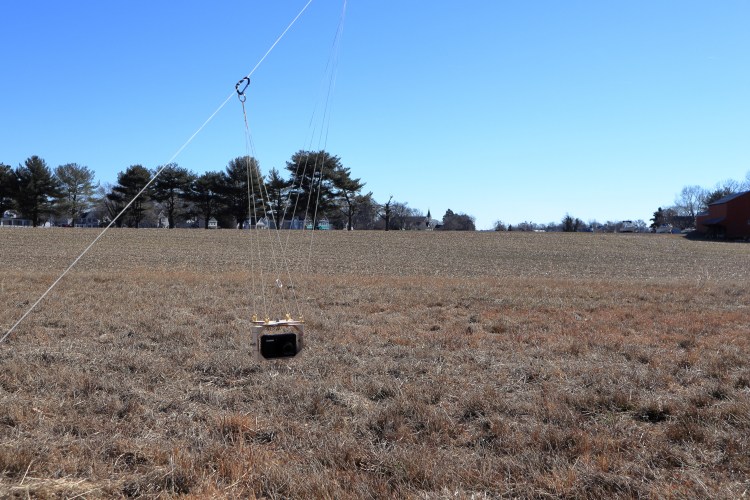
That estimation was correct. Soon after setting up the kite, it was flying steadily on 100 feet of line. The wind was blowing from the north, so flying on the south side of the bridge meant that there was no danger of the kite going over the bridge. I wouldn’t have minded an east wind to get the kite over the water and closer to the bridge, but this should do fine anyway. The kite was tending to pull to the right when the wind got stronger, so I brought it down and made a quick adjustment to the bridle. It turns out that I overdid it, because after that the kite wanted to pull to the left. That would be okay, though, because it meant that if the kite did get pulled down by a stronger wind, it would be safely over the spacious empty field. After launching the kite again, I attached my PowerShot S100 fixed autoKAP rig, started the CHDK script to take a picture every five seconds for a little over 30 minutes total, and sent it up.
I had a bit of a conundrum about how to aim the rig this time. The rig can be rotated in increments of 45 degrees. My desired framing is basically what you see at the top of the page: I wanted to get most of the bridge in the frame, including the end on the other side of the river. The wind was coming from the north, perpendicular to the bridge, so I ended up aiming the rig 45 degrees to my right (west) to hopefully get the bridge in most or all of the shots, and at least some with the desired composition. That ended up working out pretty well, though most of the images didn’t get the end of the bridge in the frame like I wanted. This is one of those cases where it would have been nice to have a radio controlled rig, but the fixed autoKAP rig still gets the job done in the end. Here are the pictures I like from the session, from a variety of different heights and angles (the second one is the cover photo above).
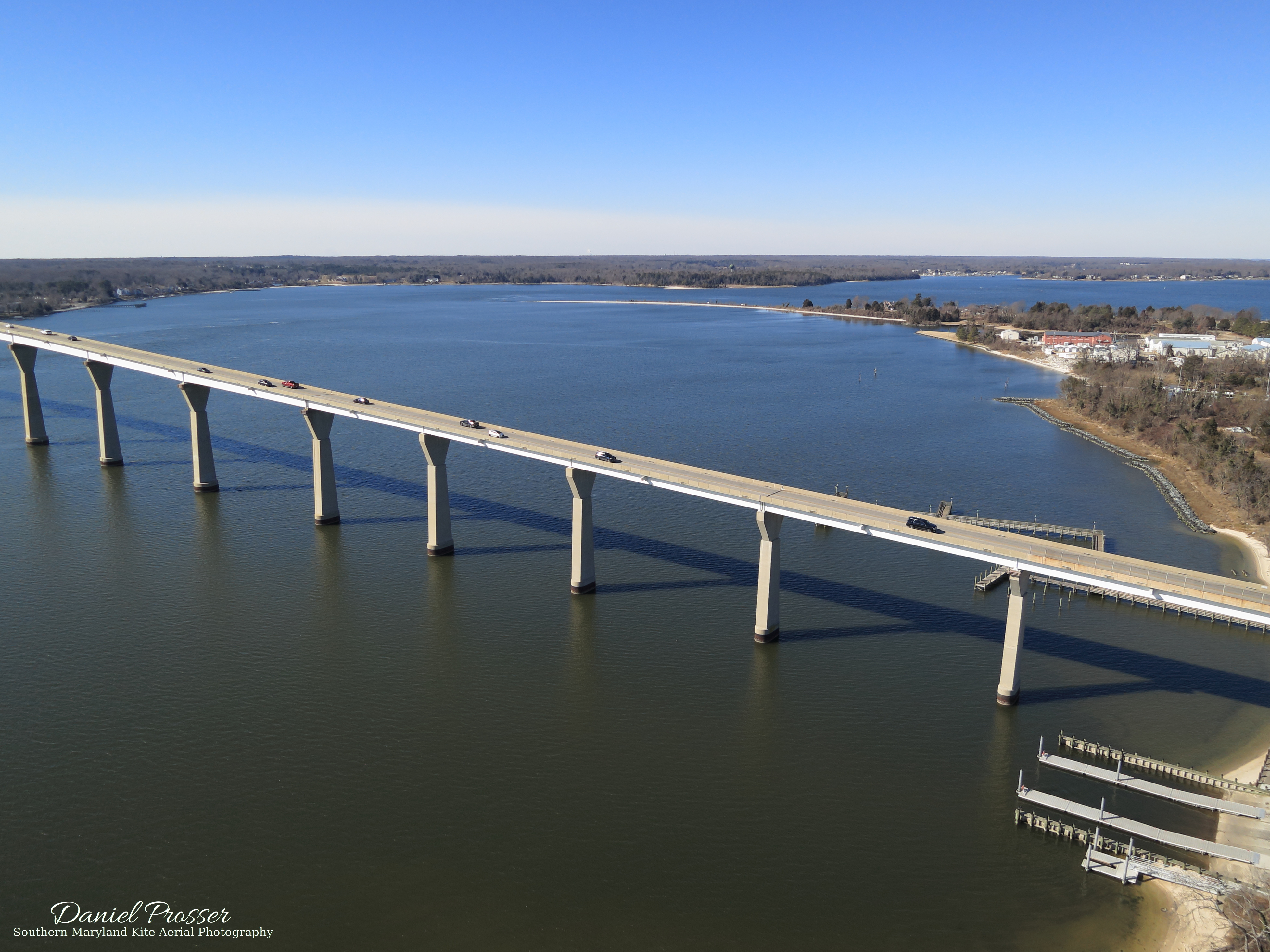

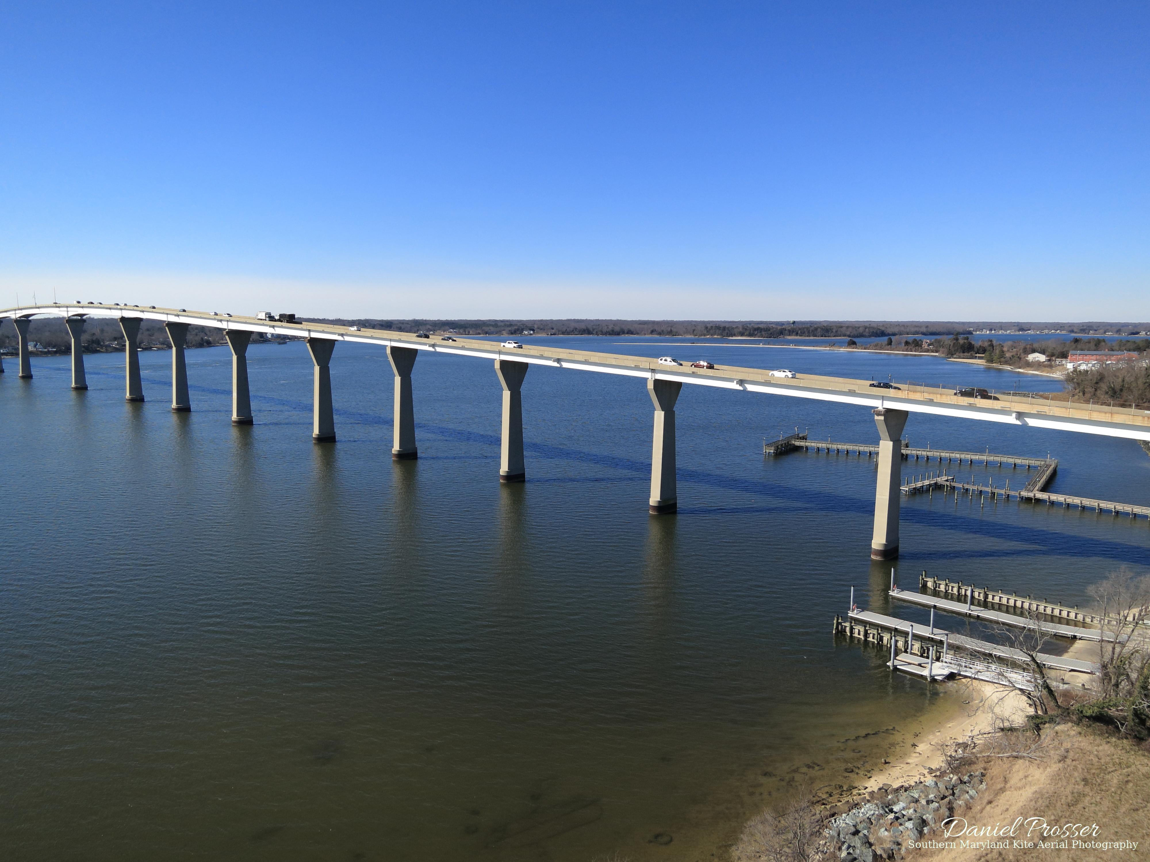
Flying was a bit of a challenge given the wind and how the kite was set up. Well, not really a challenge, but not as smooth as I would have liked. The kite was pulling pretty hard for much of the flight, and when that happens, this kite tends to go down to a low angle. It was also pulling to the left a lot due to my misadjustment of the bridle. That wasn’t all bad, though, because it resulted in some nice low altitude shots with the field and trees in the foreground, like the third one in the gallery above, which I probably wouldn’t have gotten otherwise. At times when the wind let up a bit, it managed to reach much higher angles and heights, like in the cover photo.
After awhile, I brought the camera and kite back down. While doing that, some other visitors joined my airspace, including a bald eagle and a drone, and, right as I was leaving, a whole flock of geese. This was a good outing, as it always is when the kite and camera return in one piece and you get some good pictures! I will definitely return here again, probably when there is an east wind and some green on the ground and trees. I’d also like to take some pictures of the rest of Solomon’s Island, which is to the south of where I flew this time. I’m not sure if there is another suitable flying field, but getting the kite nice and high from this site and taking pictures in that direction should work.
You can find my gallery of all images from this location here. For now, it only contains the pictures you’ve seen here, but I’m sure there will be more eventually.
Thanks for reading! If you enjoyed it and would like to read more KAP stories, feel free to subscribe to SOMD KAP by entering your email in the box on the main page.

One thought on “Governor Thomas Johnson Bridge”