Ever since I started doing KAP last year, I’ve wanted to see what my neighborhood looks like from the air. Actually, I had a good idea already, since I’ve been flying my FPV (first-person view) radio-controlled airplane from an open area at the end of my road. But the camera only does low-resolution analog video, which is not well suited to making out details, and especially not distant objects. It’s also very wide-angle, which gives a somewhat distorted view of the world. I wanted to see what the neighborhood really looks like from above, not a low-resolution, distorted approximation!
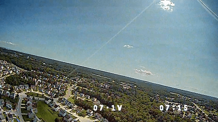
Some sample pictures from the FPV camera on the plane are presented in the gallery below. The first one shows the flying site on the bottom right. The second one shows the type of view I hope to get from the kite, except, of course, higher quality and with a level horizon. The flight video is below that too, just in case you are interested. 🙂

Alright, that’s enough about R/C airplanes. Back to kites…
The area where I fly the plane is probably the largest open area in the neighborhood that has sufficient room to fly a kite without it going over houses. I wouldn’t want to creep people out by flying a kite with a camera over their house, and I especially wouldn’t want the kite or camera to crash into a house or end up with the line strung across someone’s property or the street. There are two problems with flying from that area, though: it is lower in elevation than the surrounding land (it is actually a drainage area), and it is mostly surrounded by large trees. Both make it difficult to fly a kite there.
I realized, though, that my chances successful kite flying are significantly improved during the winter. Since the trees have lost their leaves, wind is able to pass through much more easily than during the summer. If the breeze is in the right direction, it can result in wind near ground level that is steady enough to launch a kite and get it above the trees.
Well, a day came along with conditions that seemed workable. The wind was from the north, which meant it was relatively unobstructed by hills and also would allow the kite line to extend over the length of the drainage area. That gives the largest possible safety box and also keeps the kite away from houses. It was relatively strong and gusty, up to about 20 mph, but by this time I’d flown the Mini Dopero in similar winds and knew it was up to the task.
I set up the kite and did a long line launch. The first attempt resulted in the kite floating back to earth during a lull in the wind, but the second attempt was successful. Following my experience the last time I flew this kite at Elm’s Beach Park where it was pulling very hard, I had adjusted the tow point on the bridle forward by a couple centimeters. That seemed to be just about right, since the pull was much more manageable. I was also flying with a new, more colorful drogue (made out of spare blue and yellow ripstop nylon), since the last one had been lost in the Chesapeake Bay. About 150 feet of line were needed to get the kite safely above the turbulence produced by the trees. The next step was to attach the PowerShot S100 rig to the line and start the intervalometer, which happened without a hitch.


The flight really went about as well as I could have hoped for, given the conditions and location. Once again, the Mini Dopero handled the strong, gusty winds like a champ. Gusts and variable wind direction caused it to fly off to one side or another from time to time, but there were no near crashes or real scary moments. Nonetheless, I didn’t release all the line available, just because I didn’t want to push my luck.
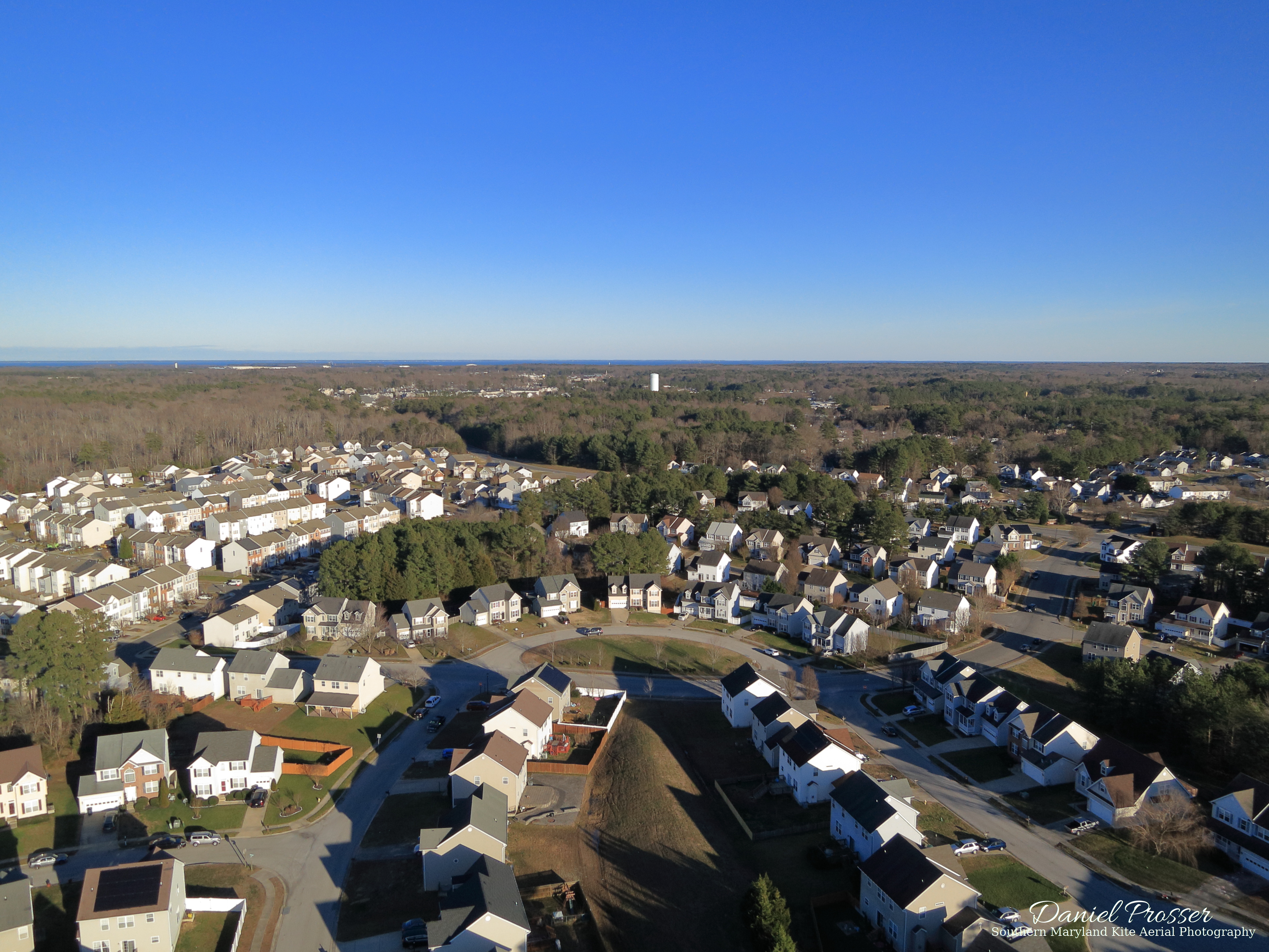
The gusty behavior resulted in images captured over just about 180 degrees of view with the fixed rig, which I see as a benefit. Some of the best shots are shown above. The quality is definitely much better than the FPV camera, of course, and they show off some of the prominent features of the area. The most noticeable feature is the big white tower off to the east. Interestingly, I never even noticed this tower until I first started flying my R/C planes around with cameras attached. It’s very prominent from the air but somewhat obscured from the ground. That’s just one example aerial views really give a different and unique perspective. Farther to the east, the control tower for the Patuxent River Naval Air Station is visible miles away. There is a small pond in the neighborhood in the first image looking towards the north, a larger one in the last image towards the south, and an even larger one beyond the neighborhood farther to the south. I even got one good shot of the flying site from above:

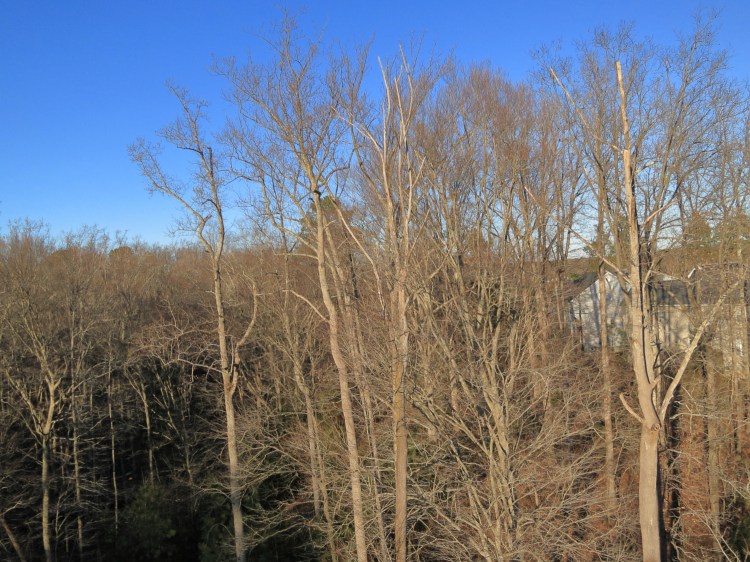
Bringing the kite back down was pretty uneventful too, except for near the ground where the turbulence from the trees caused some “interesting” kite behavior. My timing happened to be just right that the intervalometer script kept going just until I was about to land the kite, giving me some close-up images of trees:

Right after that, the script finished and the camera shut off. I detached the rig from the line and brought the kite down, being careful to keep it away from the hungry trees. Another success! I think I might be getting better at this kite-flying thing. It would be nice to try this again when there are some leaves on the trees, but I don’t know if it will be possible with the wind conditions. Anyway, you can see these and any other KAP pictures I may take from home at the My Neighborhood Aerial Photos Gallery page.

I am impressed by your ability to fly kites successfully even with challenging conditions.
LikeLike
Thank you!
LikeLike