Calvert Cliffs State Park: a place I’ve been meaning to go since I first came to Southern Maryland for an interview more than six years ago. I finally went there for the first time last Friday, June 18, when I came along with my daughter for a school trip. The site has a small beach surrounded by cliffs, and there is a two-mile hike to get there from the parking area (two miles is the minimum; you can also take longer hikes on other trails). I had considered trying to do kite aerial photography at Calvert Cliffs before, but having never been there, I didn’t know if the small beach would be suitable for launching a big kite. But while I was there on Friday, it seemed like it should be possible if the wind came from just the right direction.
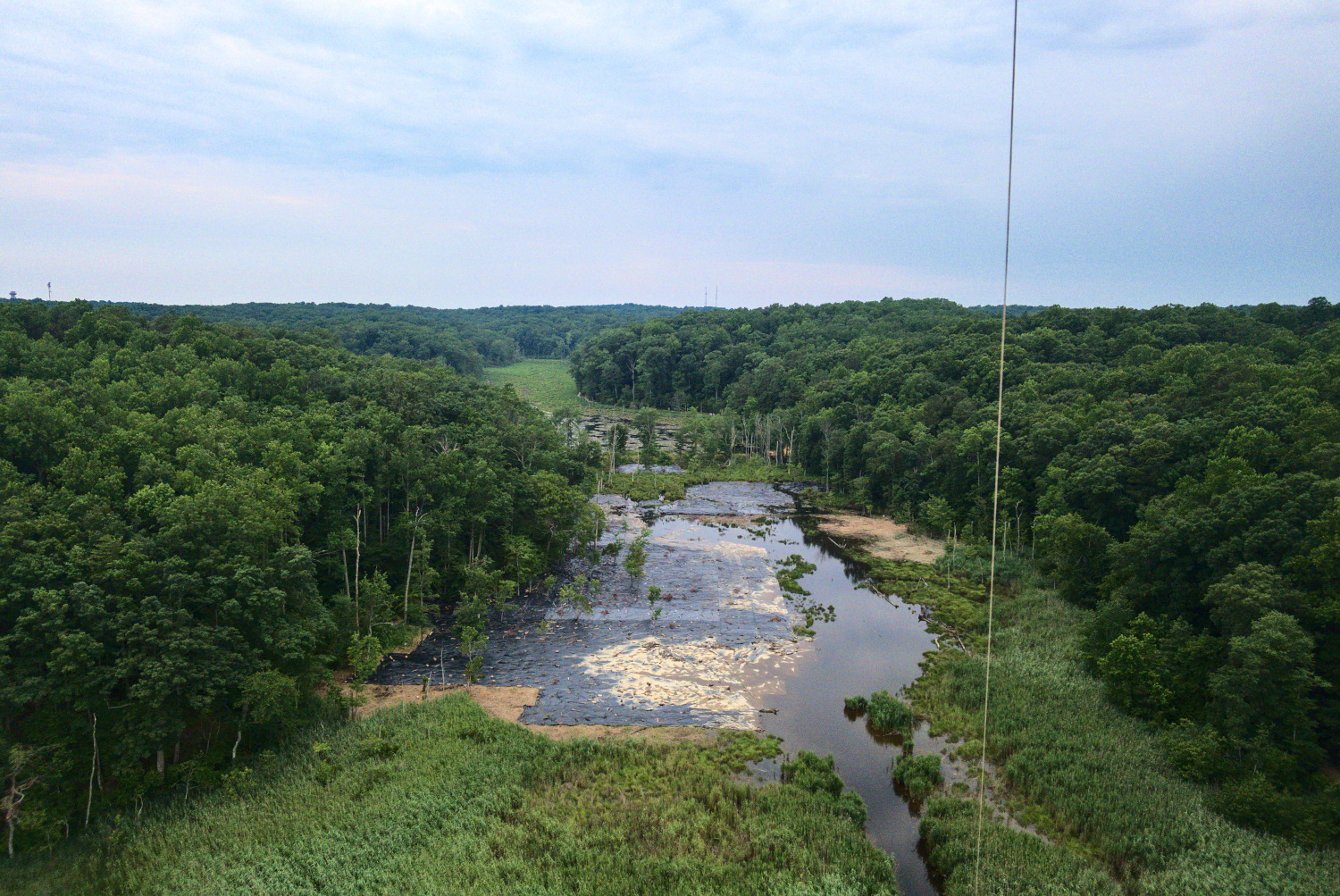
The picture above shows an area of wetlands just behind the beach, which is surrounded by forest and cliffs on either side. A west wind will flow over the wetlands area between the cliffs and provide a nice steady breeze. As luck would have it, that is just what the forecast called for on the next day (Saturday), so I decided to plan on that as a hopefully relaxing Father’s Day activity for myself.
When I got there on Saturday, the weather conditions seemed perfect, except that it was very overcast and dark. That would prove challenging for taking and editing the pictures, but I’ll discuss that more later on. The beach is very narrow, and even more so since I arrived right at high tide. I could tell that there was a steady wind by looking at the trees, but the rows of tall reeds lining the beach made it quite calm at ground level. After setting up my versatile Rokker kite and attempting a couple of vain launches into the wind, I decided to take advantage of the length of the beach and launch by running a dozen steps or so along it. This caused the kite to move crosswind, but it allowed it to get high enough above the reeds to contact the smooth breeze and fly under the wind’s power from then on.
The breeze turned out to be remarkably steady. There were few gusts, and there were no thermals at all due to the overcast conditions. Even though the water was just a few feet away, I felt confident enough to record some footage of my KAP process and turn it into a how-to video, which you can see below. (I also made a dedicated page for it here.) In the video, you can see the reeds and how narrow the beach is, as described above.
One problem was that I forgot gloves, which protect the hands from burns when handling the line. Thankfully, the steady breeze meant I didn’t need to work the line by hand much to get the kite in the air, but since the Rokker was pulling quite hard the entire time, I had to be very careful with the winder and work slowly to let out and bring in the line.


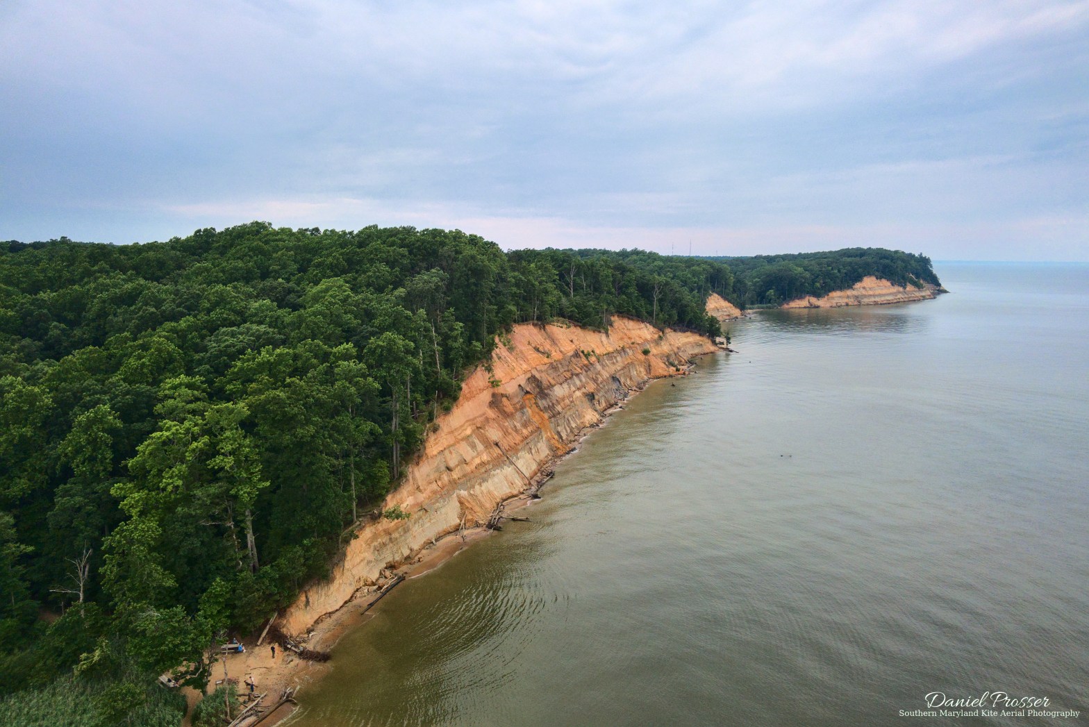
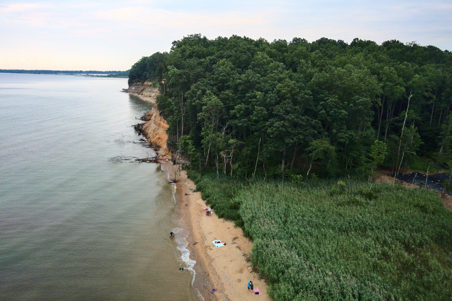
My two favorite photos from the session are in the gallery above. (The first one is also the cover photo at the top of this blog post.) The cliffs are really beautiful from the air, and actually larger than can be seen from the ground. I actually didn’t even notice that there were any cliffs at all to the south of the beach, which can be seen in the second picture. As noted above, the dark conditions made the actual photographing and editing tricky. I did reduce the shutter speed from my usual 1/1600 sec to 1/1250 sec due to the lack of light. I think I could have actually reduced it a step lower to 1/800 sec given how steady the wind was, which would have reduced the ISO of these shots a bit more. Due to the lack of natural contrast in the scene, the images turned out pretty dull by default, and I spent a good amount of time tweaking these two to add contrast, color, and to try to liven up the sky as much as possible. I always shoot in RAW, which greatly increases the amount of editing latitude for doing things like that. After all that work, I am pretty happy with how they turned out.
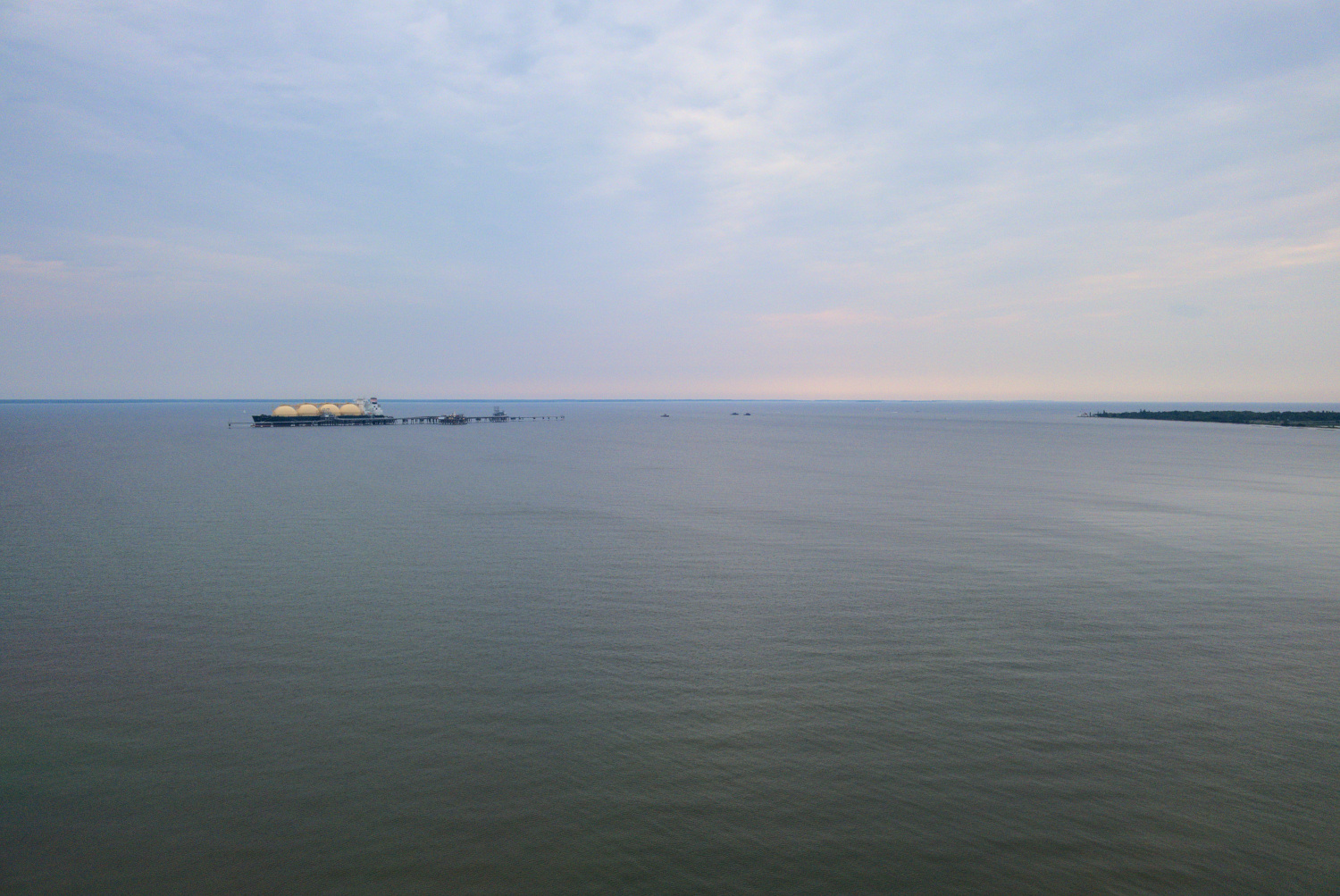
There are a few more images below, provided mainly just for other views of the area, not because they are particularly beautiful or great. The first one shows the south end of the beach from a low altitude, and the second one shows a ship that was docked in the Chesapeake Bay offshore. Presumably, the water remains shallow for a long distance away from the beach. At the end of the land to the south in this picture and the second one above, the lighthouse at Cove Point is just barely visible. The lighthouse is much easier to see in the third picture below, a zoomed-in one from the ground below that I took with my other camera. This is another site that I would love to photograph with my kite, but it seems to not be open to the public very often. I definitely need to check into it, though.

One nice effect of the small beach was that I got a lot of positive comments from people about the kite and the camera. Usually the exchange started off with something like, “That’s a big kite. What’s the thing dangling underneath it?” I got to show some of these people how it worked and a preview of the aerial photos on the camera screen. They seemed genuinely interested, which has been typical of my interactions with people while doing kite aerial photography. It’s definitely not just another drone!
Well, that’s all for this post. If you got this far, thanks for reading. It was a really fun and rewarding KAP session — actually, one of my favorites so far.

One thought on “Calvert Cliffs”